Parking and Access
Map 1
Access Points
0.0 Washington Memorial Chapel – Ample horse trailer parking in lot just east of the chapel. Follow blue-blazed connector trail down hillside to Chapel Trail; L (west) on Chapel Trail, cross over driveway to Washington’s Headquarters, follow mowed path over fields, parallel to sidewalk, down to traffic light at RTs 23 and 252 (Valley Creek Rd). (This route is approximately 1.9 miles long.)
0.0 Washington’s Headquarters – Car parking with 2 Hour time limit (no horse trailers): From Pennsylvania Turnpike exit 326 follow signs to Valley Forge National Historic Park, RT 23, Washington’s Headquarters. Use the parking lot for Washington’s Headquarters 0.4 mile east of the trail head.
0.0 Yellow Springs Trailhead parking lot (no horse trailers), 0.3 miles west of covered bridge, on Wilson Rd. Follow paved path to covered bridge, then Valley Creek Trail from bridge north 1.1 miles to access H-ST.
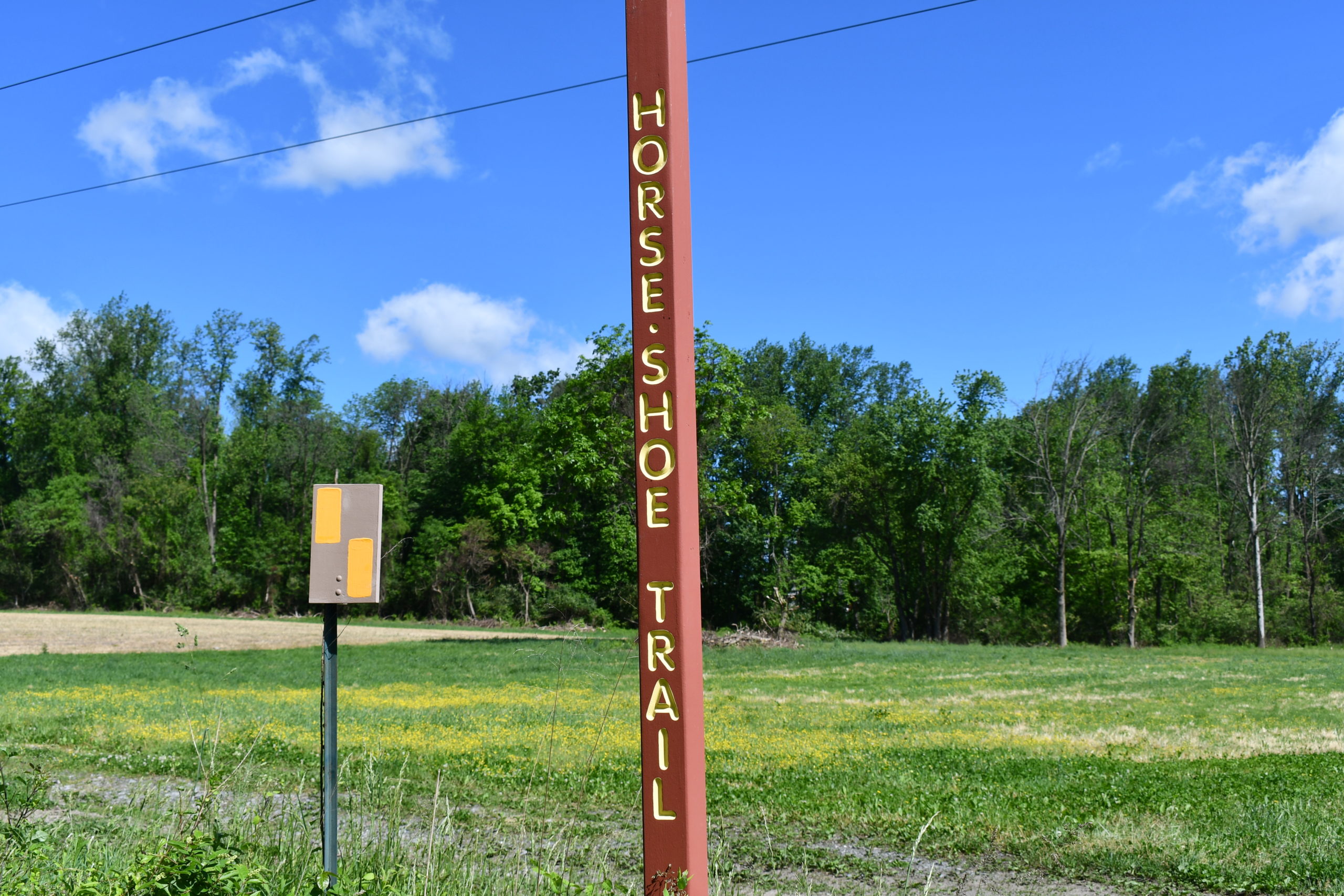
4.6 Rees Road – Ample parking on grass lot, signed “Horse-Shoe Trail Parking”; small horse trailers okay. From US-202: 1.9 miles north on RT 29; R on Whitehorse Road for 0.6 mile; R on Rees Road for 0.4 mile; lot on right.
7.5 Charlestown Elementary School – Car parking only; no horse trailers. School is on Charlestown Road about ½ mile northwest of RT 29 intersection. From Phoenixville: 4 miles south on RT 29, turn R on Charlestown Rd. From US-202: 2 miles north. If school is in session, let school office know you’ve parked there.)
10.7 Brightside Farm – Horse trailers welcome. Entrance: Yellow Springs Road just NW of intersection -with Valley Hill Road. Please park on mowed shoulder of driveway. Access the H-ST either by road, down Valley Hill; or by the mowed path along edge of the field parallel to Yellow Springs (at Yellow Springs & Hollow: west into Deerfield; east, continue around field). DO NOT RIDE OR WALK ON THE HAY FIELDS. Fox hunting rules apply. Please do not sweep out trailers on the property. To exit the property, come down to the fork in the driveway, take the left fork, go straight then stop, back up between the two barns and then go back out the way you came. Please do not turn around in front of the house.
Map 2
Access Points
0.0 Montgomery School’s baseball field – 3-car space at corner of RT 113 and Horseshoe Trail, at edge of baseball field. From exit 312 of the PA Turnpike south on RT 100 for 1 mile, turn L, north on RT 113 for 2.6 miles. L on to Horseshoe Trail, immediate R into lot.
0.2 Chantilly Lane – 10-car lot beside school bus stop. From corner of RT 113 and Horseshoe Trail, continue NW on Horseshoe Trail 0.2 mile, L on Chantilly Lane.
6.6 Collinson Inc., on RT 100 (300 yds south of Fairview Rd) – on weekends and holidays. No horse trailers.
7.5 Welkinweir Nature Preserve – From exit 312 of the PA Turnpike follow RT 100 North for 6 miles. L on Prizer Road for 0.8 miles. Or, from intersection of RTs 100 & 23, south on RT 100 for 1.1 miles, then R on Prizer Road for 0.8 miles. Parking available for hikers and equestrians at the lot west of the barn, accessed from Prizer Road. NOTE: Horse trailers should park on the circle. Horses are only permitted on the blue-blazed access trail, which leads to the H-ST. The access trail is at the west end of the parking lot. Groups please call ahead (610-469-7543). Gate to parking area may be closed late afternoon or after dark and on weekends.
9.6 French Creek Elementary School multi-car lot, ONLY when school is closed. No horse trailers.
10.5 Mt. Pleasant Road – small lot about 100 yards south of RT 23; at northeast edge of Warwick County Park.
12.3 Warwick County Park (main entrance) – 191 County Park Road, Pottstown, PA 19465. Located 3.5 miles west of RTs 100/23 intersection. From RT 23 in Knauertown, south on County Park Road (near the Village Market). Go over bridge then L through main entrance, to several parking areas, the park office, shelters, and other Day Use facilities. Horse trailers ok.
Map 3
Access Points
0.0 St. Peters Village – From RT 23 in Knauertown north 0.5 miles. A large parking lot is on the northern end of the little village. Horse trailers allowed. The Trail is reached by crossing the cement bridge at the parking lot, straight ahead a short distance, then by following blue-with-yellow-dot blazed trail (on L) for 0.15 miles.
3.6 Game land 43 at Harmonyville Road – game land lot (horse trailer accessible). From RT 23 / RT 345 intersection, north on RT 345 about 1.9 miles; R on Harmonyville Road 1.1 miles; R into lot, after bridge.
5.4 Hopewell Furnace National Historic Site –
Open hours vary by season. Rest facilities always available. Located on RT 345 between Warwick on RT 23 to the south and Birdsboro on RT 724 to the north.
Accesses to Trail:
1. Hikers: From visitors center parking lot walk halfway downhill to meet Trail; turn right for Trail going West, turn left – downhill – for Trail going East.
2. Equestrians: Hopewell provides trailer parking and an access trail to the Horse-Shoe Trail from the upper parking lot. Please use the blue-blazed trail from the upper lot and through the woods; L on dirt road to “T”. R to connect with the H-ST/West, towards French Creek State Park; L to connect with H-ST/East, through Hopewell Village.
6.7 French Creek State Park, Hopewell Lake – On the west end of the lake is a large picnic area with parking lots and rest rooms. Trail crosses Park Road 0.4 miles north of here. No overnight parking. Park Office nearby to the west (Park trail maps available).
10.6 French Creek State Park, Fire Tower Road – Look for and follow Fire Tower Road. Parking lot at the bottom of Williams Hill. Trail crosses a few yards beyond gate at bottom of hill. No overnight parking. Horse trailers okay.
11.8 French Creek State Park, Scotts Run Lake – Follow signs to Scotts Run Lake. The Trail runs beside only parking lot on the lake, at the dam. Picnic area, rest rooms. No overnight parking.
13.6 French Creek State Park, Geigertown Road — small 5-car gravel pull-out, across from South Birdsboro Archery and Gun Club. (NOTE: Parking is no longer allowed at the Gun Club.) From Birdsboro take RT 345 south for 2 miles, then R on Geigertown Road 1.1 miles. [Or, from Turnpike exit 298 (Morgantown) take RT 23 east to Elverson, then RT 82 north to Geigertown, then R on Geigertown Road 2.3 miles.] No horse trailers. With CAUTION, cross Geigertown Road to the blue-with-yellow-dot blazed access trail.
16.6 Hay Creek Road / Furnace Road, Geigertown – Trail crosses Haycreek Road (old RT 82) one mile north of Geigertown, at Furnace Road intersection. Ample parking for cars and trailers in new (2023) Division of forestry parking area on Hay Creek Road (just north of Furnace Road).
Map 4
Access Points
0.1 Furnace Road (near Haycreek Road), Geigertown – Trail crosses Haycreek Road (old RT 82) one mile north of Geigertown at Furnace Road intersection. Ample parking for cars and trailers in new (2023) Division of forestry parking area on Hay Creek Road (just north of Furnace Road).
4.4 RT 10, Plowville at Alleghenyville Road – Look for school buses parked on SW corner with Alleghenyville Road. Parking on SE corner. From exit 298 of the PA Turnpike (Morgantown), go north 6 miles on RT 10. From Reading go south 9 miles on RT 10 (Morgantown Road). (See INTEREST for Joanna Furnace.)
TRAIL TEMPORARILY CLOSED AT I-176 crossing for PENDOT bridge replacement!
Estimate is from October 20, 2025 until July 2026.
4.8 West side: Landowner at 151 Alleghenyville Road (Mohnton) has provided some space for hiker parking. You can pass “ROAD CLOSED” sigs as “local” traffic. Turn down the driveway at 151, Then turn right to pass above the barn, then loop down to the left where you will see signs directing you to park between them. DO NOT PARK ON GRAVEL LOOP DRIVEWAY or construction vehicle entrance (your car will be moved and they have BIG toys to move it with). Landowner and construction vehicles need clear access to this loop. If designated spaces are full, you may park on the grass in front of the barn.
No overnight or horse trailer parking and please thank and respect our landowner hosts.
9.4 Brecknock Township, Berks County, municipal building – From RT 10, go 3.4 miles west on Alleghenyville Road. Horse trailers allowed. To reach the Trail: from the east end of parking lot, take blue-with-yellow-dot blazed access trail 0.3 miles up over ridge to meet the Horse-Shoe Trail.
12.5 RT 625 (New Holland Road) – Small parking area (4 car) on west side of road. 0.8 miles south of RT 568.
Map 5
Access Points
0.0 RT 625 (New Holland Road) – Small parking area (4 car) on west side of road. 0.8 miles south of RT 568.
2.5 RT 272 – Commuter parking area on southwest corner of intersection of RTs 272 and 568, adjacent to US-222, across from Crystal Spring.
8.0 Dutch Cousin Campground, Hill Road – From Turnpike exit 286, north on RT 272, turn L just before Park Place Diner on Hill Road 0.8 miles. 446 Hill Road, Denver, PA 17517. www.dutchcousin.com (800) 992-0261 or (717) 336-6911. Let campground office direct to parking.
12.8 Trailside Drive cul-de-sac – NO PARKING HERE (due to folks blocking driveways). From PA Turnpike exit 286: north on RT 272; turn L onto Hill Road, to L onto Smokestown Rd to R onto Reinholds Rd to L onto Miller Rd; Miller Road to Ridge Road; jog R on Ridge then L onto Horseshoe Trail Road; at “T” turn L onto Swamp Bridge Road to Wollups Hill Road; sharp R on Wollups Hill Road to Trailside on R.
Map 6
Access Points
0.0 Trailside Drive cul-de-sac – NO PARKING HERE (due to folks blocking driveways). From PA Turnpike exit 286: north on RT 272; turn L onto Hill Road, to L onto Smokestown Rd to R onto Reinholds Rd to L onto Miller Rd; Miller Road to Ridge Road; jog R on Ridge then L onto Horseshoe Trail Road; at “T” turn L onto Swamp Bridge Road to Wollups Hill Road; sharp R on Wollups Hill Road to Trailside on R.
6.0 Middle Creek Wildlife Management Area, Kleinfeltersville Road – Limited car parking along road, near the dam. Trail crosses road and creek here.
6.0 Middle Creek Visitors Center, on Museum Road, is a popular meeting place with lots of car-only parking. It is just off Hopeland / Kleinfeltersville Road, 2.5 miles south of RT 897 at Kleinfeltersville, 5.8 miles north of US-322. No direct access from Turnpike.
7.1 Middle Creek, Elders Run North (Laurel Drive at Woodcock Drive) – Large game land lot (horse trailer accessible) at Elders Run north trail head, 0.3 miles from the H-ST.
7.1 Middle Creek, Elders Run South (Mountain Spring Road) – small game land lot (horse trailer accessible, but awkward), 1.1 miles from the H-ST at Elders Run south trail head.
9.6 Middle Creek, Fox Road – large game land lot (horse trailer accessible). From RT 501, just south of the Pretzel Hut, 1.1 miles on Fox Road, R on to game land gravel access road to parking area. From parking, 0.2 miles south to the Trail.
11.9 Route 501, opposite The Pretzel Hut – Although there is parking at “the Hut”, we ask trail users to park in the wide lot across RT 501 from the luncheonette. From the PA Turnpike exit 266 take RT 72 north, then US-322 east to Brickerville, then RT 501 north. (Total 11 miles). From Lancaster and Lititz take RT 501 north. From Schaefferstown, take RT 501 south.
14.4 US-322 & Pumping Station Road – Game Land parking lot at this crossing. From PA Turnpike exit 266 take RT 72 north for 2 miles, turn R, US-322 east for 6 miles.
Map 7
Access Points
0.0 Route 322 & Pumping Station Road – Game Land parking lot (SGL 156) at this crossing. From PATurnpike exit 266 take RT 72 north for 2 miles, turn R, US-322 east for 6 miles. Horse trailer accessible.
0.2 Upper Hopewell Forge – Pumping Station Road just south of US-322. Horse trailer accessible.
1.7 Cornwall Fire Tower Road (aka Horseshoe Trail Road) (mid-way) – Fire Tower Road begins at the south side of US-322, 2.4 miles northwest of Pumping Station Road and 3.2 miles east of junction RTs 72 & 322. No sign at turn-off. Parking for 4 or 5 cars where the road makes hairpin turn and the trail joins the road from the east.
2.7 Cornwall Fire Tower Road (aka Horseshoe Trail Road) (end) – Ample parking for 20+ cars or 5 horse trailers is available where public access to road ends, just before H-ST turns north and down the hill.
3.7 Camp Shand – Parking and camping on the camp property (formerly Penryn Park) with permission only: (717)-272-8001. From PA Turnpike exit 266 north on RT 72 for 1.7 miles, then east on US-322 for 2.7 miles, R and south at sign for Y-camp on private dirt road (Penryn Lane) for 0.8 miles. Trail crosses at the baseball field. The YMCA buildings are 0.4 miles farther.
8.4 Route 72 opposite Spring Hill Acres – From exit 266 of the PA Turnpike 1 mile north on RT 72. From Lebanon 5 miles south on RT 72. Do not block the gate. (Parking for 4 or 5 cars.)
9.8 RT 117, south side, Governor Dick lot – parking for 5 to 7 cars.
11.3 Pinch Road, east side, at Governor Dick monument Parking on Pinch Road will accommodate 8 to 12 cars; not suitable for horse trailers.
11.9 Game land 145 at Pinch Road, west side, (opposite entrance to Environmental Center) – From PA Turnpike exit 266, south on RT 72 for 0.9 miles, R on Cider Press Road for 0.45 mile. R on Pinch Road for 1.6 miles. The game land parking lot is at the crest of a hill on left. The Trail passes through parking lot. (Parking for 15+ cars or 5 horse trailers.)
11.9 Environmental Center (Pinch Road, east side) – ample parking in lot adjacent to the center. Although horse trailers are permitted, parking them here is awkward; game land lot across Pinch Road preferred.
14.9 Mt. Wilson Road, Colebrook – From PA Turnpike exit 266, north on RT 72 and follow signs to Mt. Gretna — sudden jug handle exit off RT 72. Continue on RT 117 through Mt. Gretna to “T” in Colebrook. L on Mt. Wilson Road for 0.2 miles. Game land (SGL No. 145) parking lot on left where the Trail crosses. Parking for many cars; horse trailers okay.
Map 8
Access Points
0.0 Mt. Wilson Road, Colebrook – From PA Turnpike exit 266, north on RT 72 and follow signs to Mt. Gretna — sudden jug handle exit off RT 72. Continue on RT 117 through Mt. Gretna to “T” in Colebrook. L on Mt. Wilson Road for 0.2 miles. Game land (SGL No. 145) parking lot on left. Parking for many cars; horse trailer accessible.
1.7 RT 117 west of Colebrook – In Colebrook go north on combined RTs 117 and 241. When they split, take RT 117 to the left. Game land parking lot (SGL No. 145) is 0.3 miles farther on the left. The Trail crosses the parking lot. Parking for many cars; horse trailers okay.
4.6 RT 117 and Weaber Avenue – The Trail is on Weaber Ave., where you can park. Room for several cars along street. Not good for trailers.
5.6 End of Drescher Road – parking for several cars or a horse trailer at turn around, abutting the property at the end of Drescher. From Campbelltown / US-322, south on RT 117 (S Forge Rd) 0.3 miles; bear right onto Bell Road for 1.0 mile. Turn left at Lawn Road, go 0.1 miles. Turn left on to Drescher Road, 0.4 miles; at Y, slight right to stay on Drescher, to large turn-around area.
8.9 Church of the Nazarene, Hershey – on south side of US-322 (E. GoveHershey. Extensive parking in back of the church. Horse trailers are welcome, but please do not sweep out trailers on the property.
11.6 Palmdale Park – sizeable parking lot at soccer fields. Car parking only, not suitable for horse trailers. Located between Hershey and Palmyra. From US-422 in Palmdale, take Washington Ave 0.1 mi. south to park.
12.5 Hershey Country Club at white barn on East Derry Road – Parking for many cars; horse trailers okay. If overnight stay is needed, notify Golf shop (located about 0.2 miles east). Parking on grass is OK but PLEASE do not block access to barn or equipment.
17.3 Boathouse Park, at Swatara Creek – From US-422 in downtown Hershey, north on RT 743 for 0.8 miles, cross Hershey Park Drive and continue straight on Sand Beach Road for 1.2 miles to Boathouse Rd./Swatara Rd. (just before bridge over Swatara Creek). L on Boathouse Road, then R into park. Parking for many cars; horse trailers okay.
Map 9
0.0 Boathouse Park, at Swatara Creek – From US-422 in downtown Hershey, north on RT 743 for 0.8 miles, cross Hershey Park Drive and continue straight on Sand Beach Road for 1.2 miles to Boathouse Rd./Swatara Rd. (just before bridge over Swatara Creek).L on Boathouse Road, then R into park. Ample parking for both cars and horse trailers.
2.6 Devonshire Heights / Devonshire Road – parking available on this road at a paved parking area near the historic Balsbaugh Family Cemetery. (1.1 miles east of Hershey Road/RT 39; 0.9 miles west of Sand Beach Road.) Short-term parking for cars and 1-2 horse trailers.
4.4 South Mill Road – Room for 1 or 2 cars, at intersection of S. Mill and Carlson roads. From Hershey: US-422 in downtown Hershey, north on RT 743 for 0.8 miles; cross Hershey Park Drive and continue straight on Sand Beach Road 3.3 miles; L onto Crooked Hill Rd 0.9 miles; L onto Carlson Road 0.1 miles to intersection with South Mill. From I-81: exit 77 for RT 39; south on RT 39 for 1.2 miles to US-22; L (east) on US-22 for 1.1 miles; R onto S. Mill for 0.6 miles to Stop sign (intersect with Carlson Road).
10.2 Fort Indiantown Gap (FTIG) parking area at McLean Road / RT 443 – From I-81, take exit 80. Head north on Bow Creek Road to “T”. Turn L onto RT 443 (Mountain Road) for 2.7 miles. R on McLean Road, over bridge.
NOTE: Parking in this area must be contained to the edge of the Fort Indiantown Gap boundary, along the sides of the unpaved McLean Road, near the bridge. You must keep McLean Road clear; it is the principal access road for emergency vehicles at the western end of FTIG. These parking restrictions apply:
Limited parking – two or three cars – to the left (west) of McLean Road, just after crossing the bridge. Park well off roadway. No permission from Fort Indiantown Gap’s Range Control is needed, but checking with Range Control is recommended, to be advised of training activities in the area. All riders with horse trailers and / or multi-car groups wishing to use this parking area MUST obtain permission from Range Control at least 24 hours in advance of your planned ride / hike. The fields to the right (east) of McLean Road are usable for trailers and multiple cars, with that permission. To check in / obtain permission from Range Control, call (717) 861-2152 to clear with the officer in charge.
Map 10
Access Points
0.0 Fort Indiantown Gap (FTIG) parking area at McLean Road / RT 443 – From I-81, take exit 80. Head north on Bow Creek Road to “T”. Turn L onto RT 443 (Mountain Road) for 2.7 miles. R on McLean Road, over bridge.
NOTE: Parking in this area must be contained to the edge of the Fort Indiantown Gap boundary, along the sides of the unpaved McLean Road, near the bridge. You must keep McLean Road clear; it is the principal access road for emergency vehicles at the western end of FTIG. These parking restrictions apply:
Limited parking – two or three cars – to the left (west) of McLean Road, just after crossing the bridge. Park well off roadway. No permission from Fort Indiantown Gap’s Range Control is needed, but checking with Range Control is recommended, to be advised of training activities in the area.
All riders with horse trailers and / or multi-car groups wishing to use this parking area MUST obtain permission from Range Control at least 24 hours in advance of your planned ride / hike. The fields to the right (east) of McLean Road are usable for trailers and multiple cars, with that permission.
To check in / obtain permission from Range Control call (717) 861-2152; clear things with the officer in charge.
4.3 RT 443 (Fishing Creek Valley Road) Game Land No. 211 parking lot – (0.4 mile south of H-ST). From east: From Manada Gap go west on RT 443 for 3.5 miles (Mountain Road, which becomes Fishing Creek Valley Road at West Hanover township line). Game land entrance and parking lot on your R. From west: From Harrisburg on I-81, take exit 67B onto US-22 W/ US-322 W, towards Lewistown. Go 3 miles to exit for RT 443 / Fishing Creek. R (east) on 443 – Fishing Creek Valley Road – for 8.5 miles. Game land No. 211 entrance on L. To reach the trail: from top of parking lot, go north around gate, following service road (note blue-with-yellow-dot blazes) 0.4 miles to join the H-ST at MP 4.3.
9.5 Stony Creek valley / Buckeye Pipeline / Game land No. 211 parking lot
From Harrisburg on I-81, take exit 67B onto US-22 W/ US-322 W, towards Lewistown. Continue on US-22 W / US-322 W for about 5.4 miles. Exit at Dauphin Boro/Stony Creek. At end of exit ramp, go 1 block on Allegheny Street.bRon Schuylkill Street, then R on Erie Street to “T”. L on Stony Creek Road, (a.k.a. Stoney Creek Road); go 5 miles; paved Stoney Creek Road ends at turn-around; pot-hole riddled gravel road (Ellendale Road) begins. Continue northeast on gravel road to game land parking lot at gate. To reach the trail: proceed past gate and along cinder rail grade 3.1 miles, to join H-ST at MP 9.5.
13.3 Appalachian Trail & RT 325 (Clarks Valley)
From Harrisburg on I-81, take exit 67B onto US-22 W/ US-322 W, towards Lewistown. Continue on US-22 W / US-322 W roughly 5.8 miles to RT 225 NORTH (Halifax) – Peters Mountain Road. Complex exit ramp — follow RT 225 signs. Go 1.8 miles. R on RT 325 EAST for 9.8 miles into Clarks Valley. AT marker and parking lot are on the right. Horse trailers are not permitted. To reach the terminus of the H-ST walk 3.2 miles east on the AT.